Gain the insights needed for successful land development projects.
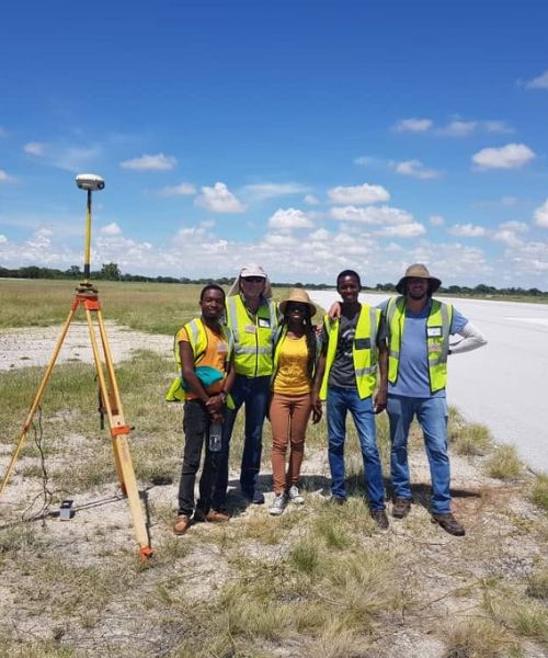
Your projects deserve accurate & reliable land surveying solutions. In the world of surveying, even small errors can lead to significant delays, cost overruns, and legal challenges. Knowing your project based on precise and reliable data allows you to move forward with confidence. Baard and Van Niekerk is headed by the Chris de Wet, a professional land surveyor practicing since 1986, bringing his 30 plus years of experience to your projects.
Learn More
In addition to his 30 years of experience Chris de Wet Holds the following credentials & qualifications:
A 5 year B.Sc. Land Surveying Degree from the University of Pretoria.
Member of the Institute of Professional Land Surveyors of Namibia.
Member of SURCON(Namibian Council for Professional Land Surveyors, Technical Surveyors and Survey Technicians).
Professional Land surveyor qualified in all survey tasks.
Our Aim is to deliver a product by adhering to the following principles:
Cutting-Edge Technology
Utilizing the latest surveying tools and advanced technology for required accuracy and efficiency.
Experienced Expertise
A team of seasoned surveyors with years of experience, ensuring comprehensive and insightful results.
Attention to Detail
Meticulous focus on even the smallest aspects, guaranteeing precise land measurements and analysis.
Tailored Solutions
Crafting customized surveying approaches that cater to the unique needs of each client and project.
Rapid Turnaround
Efficient workflows that deliver prompt results without compromising the quality of data collected.
Quality Assurance
Rigorous quality control processes that validate the accuracy and reliability of every survey conducted.
our services
What We Do
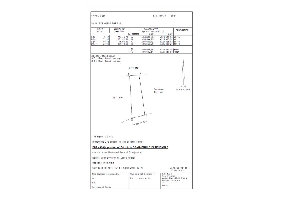
Cadastral Surveys
Precise cadastral surveys, delineating boundaries with accuracy for informed land management and legal compliance to ensure project success.
DISCOVER THE APPLICATIONS
Cadastral Surveys are reserved for Professional Land Surveyors and refer to any survey carried out in connection with the following:
a. Subdivision of single or multiple Erven situated within Local Authority Areas:
After an owner has obtained approval from the Local Authority and Ministry of Urban and Rural Development for subdivision, the appointed Land Surveyor submits diagrams of the new Erven to the Surveyor-General for approval. Once the approved diagrams are available, transfer of the new erf or erven can be registered in the Deeds Office.
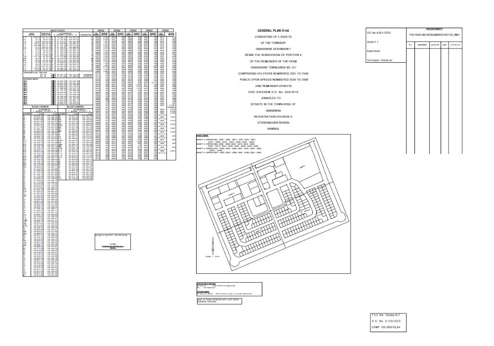
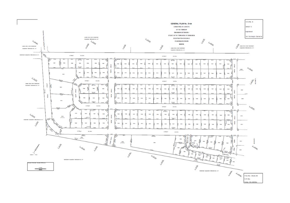
b. Township Surveys:
Township Surveys refer to the subdivision of a portion of land into a large number of erven, usually 200 or more. Before the survey can proceed, the township establishment applications to the Local Authority and Ministry of Urban and Rural Development must be completed. These are lengthy procedures and may take quite a while. The end result is the framing of a General Plan approved by the Surveyor-General, registered in the Deeds Office, whereafter transfer to the new owners can take place.
c. Subdivision of Farm land:
Should the owner of a farm wish to subdivide his land, application must be made to the Ministry of Agriculture, Water & Forestry. An important factor is that the new portion must be economically viable which is determined by the following factors. • For large cattle, 250 is the minimum number considered to be economical. • For small cattle, the factor is 5:1, therefore 1250 sheep is the minimum number considered to be economical. • For any given area, the grazing factor is used to calculate the area that the new portion can be. For example, if the grazing factor is 3 – 5 hectare per sheep, the new portion must be 3750 – 5000ha. • If the land has enough underground water available for irrigation to provide additional food for the cattle, the minimum area may be reduced further. After approval for the subdivision, the owner must then appoint a Professional Land Surveyor to carry out the subdivision survey and submit the diagram to the Surveyor-General for approval.
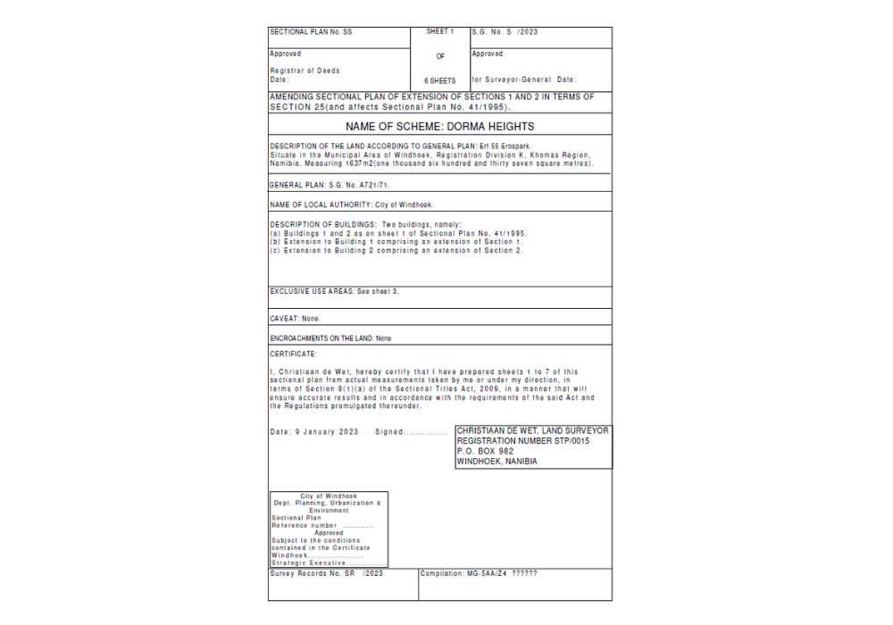
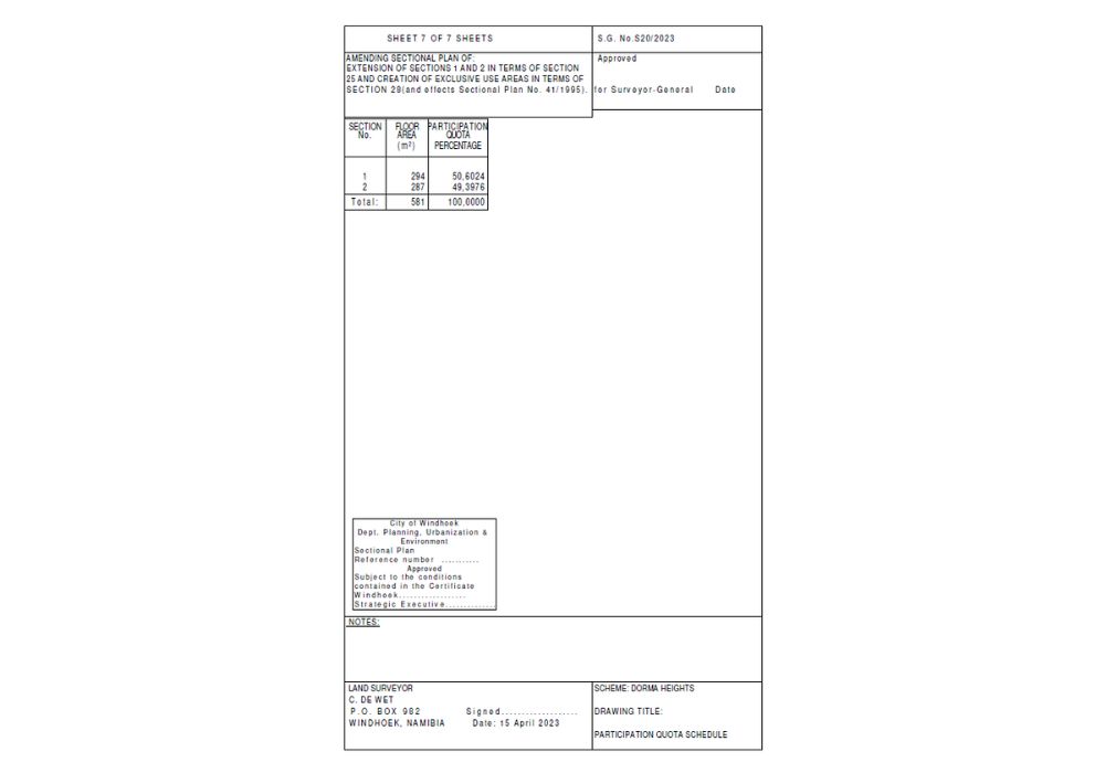
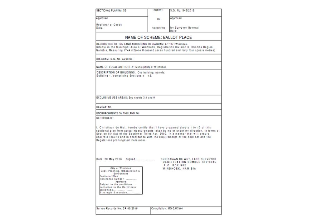
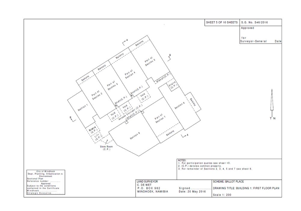
Sectional Title Surveys
Precision mapping of property boundaries and subdivisions, ensuring accurate legal documentation for sectional title ownership.
DISCOVER THE APPLICATIONS
The purpose of Sectional Title Development is to allow a person to own property, in this case a permanent structure without personally owning the land on which it has been constructed. Examples are one or more dwellings on a single portion of land that can be subdivided into sections of which ownership can be registered in the Deeds Office. The owners of the sections form a Body Corporate which is the owner of the land. There are several scenarios that can come into play which are described below.
• If a developer wants to register a Sectional Title Scheme on his property for the first time, he must have up-to-date building plans approved by the local authority. A Professional Land Surveyor is then appointed to survey the buildings and create a set of Sectional Title plans which will be submitted to the Surveyor-General for approval. The approved plans will then be submitted to the local authority for endorsement whereafter the Sectional Title Scheme can be registered in the Deeds Office and the Body Corporate created.
• If an owner of a section in an existing Sectional Title Scheme wants to extend, subdivide, consolidate his sections, or register an Exclusive Use Area, permission must be obtained from the Body Corporate whereafter a Professional Land Surveyor can then survey and create a set of Sectional Title plans. These plans must also be endorsed by the Local Authority whereafter registration can take place in the Deeds Office.
• It is important to note that there are many instances where owners have extended a section without following the proper procedures. This is illegal as the extension is done on land belonging to the Body Corporate, the participation quota has increased but not reflected on a sectional title plan and levies not adjusted accordingly.
Engineering surveys
Applying precise measurements and analysis to support construction, infrastructure, and development projects.
DISCOVER THE APPLICATIONS
For any project, be it for manufacturing of goods, road construction, real estate development or other applications, the design is of utmost importance for successful completion of a project. The design in turn is based on survey data that is collected through a variety of means that include ground surveys, GPS surveys, photogrammetric surveys, lidar surveys and others.
The end result is usually a set of co-ordinates that can be manipulated in sophisticated software to create 3D designs.
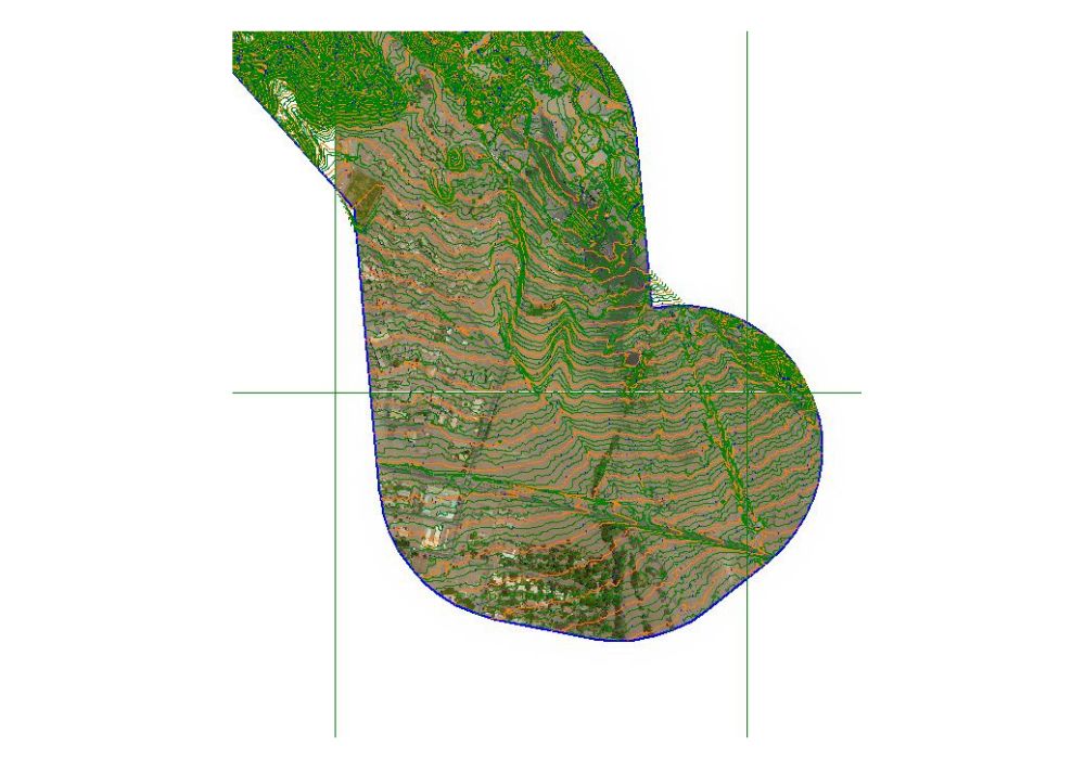
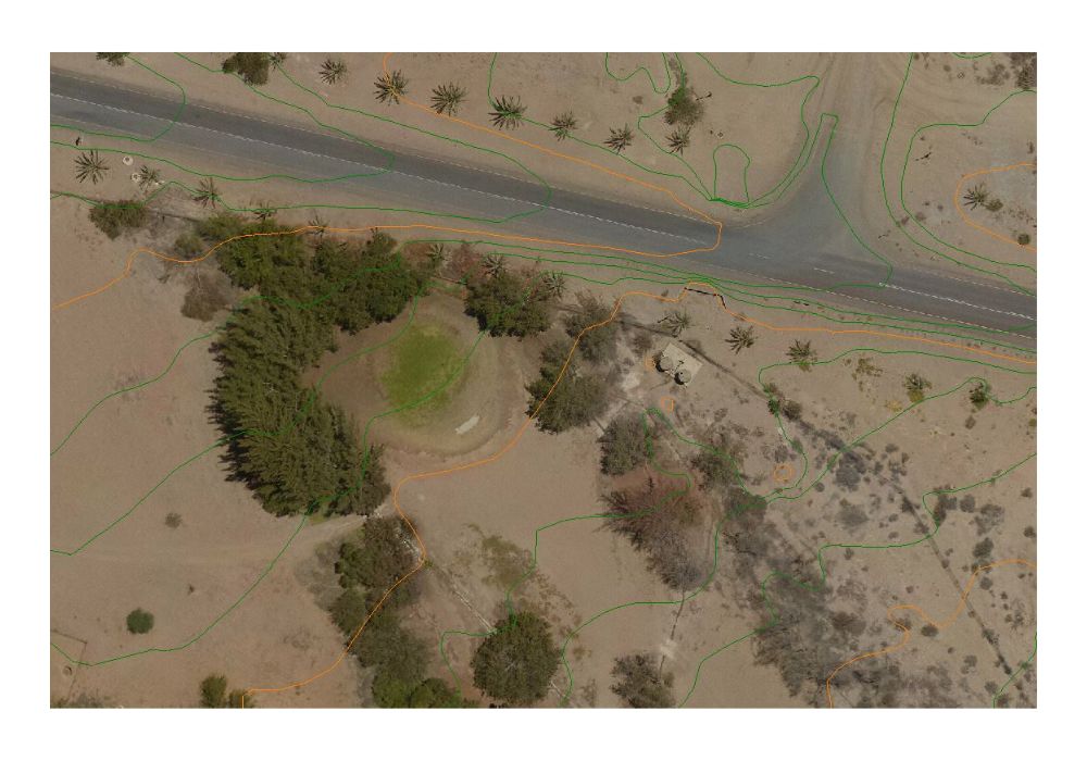
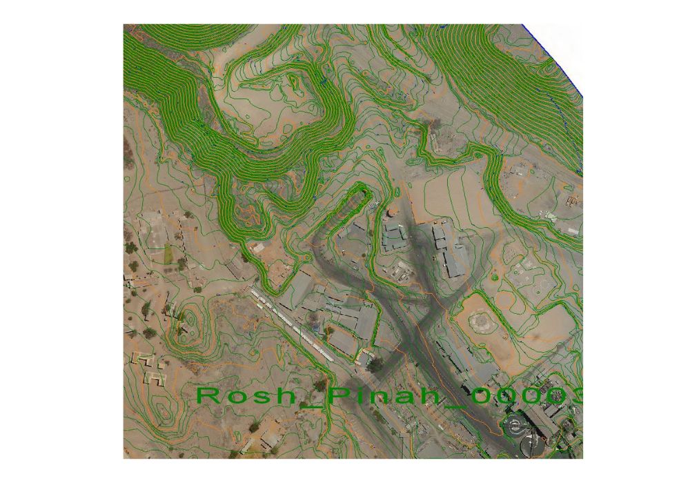
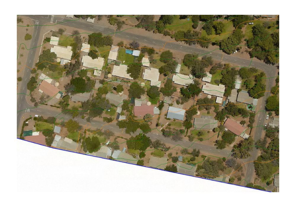
Aerial Surveys
Due to revolutionary advances in aerial survey technology, it is now possible to gather data through photogrammetry, infrared scanning, lidar scanning and other methods to capture data for a use in may fields.
DISCOVER THE APPLICATIONS
Aerial surveying involves aircraft or drones to capture detailed data for mapping, land assessment, and environmental monitoring. Practical examples include creating topographic maps for construction, assessing crop health in agriculture, and surveying disaster-affected areas for efficient response and recovery. This approach expedites project planning, reduces fieldwork, and improves decision-making accuracy across various sectors. We provide a wide range of aerial surveys in collaboration with Bushskies aviation.
Generate maps, contours, volumes, and specific interpretation of this data for a host of applications in the agriculture-, engineering – and architectural- fields to name but a few.
Lidar Surveys
Lidar, short for Light Detection and Ranging, is a remote sensing technology that uses laser light to measure distances and create detailed, three-dimensional maps of the surrounding environment.
DISCOVER THE APPLICATIONS
Initially a single laser beam could be reflected off a prism back to a total station to measure accurate distances. This concept has now been refined to measure multiple points and so create a DTM point cloud which is much more accurate than photogrammetry methods.
Infrared Surveys
Infrared surveys involve the detection and analysis of infrared radiation emitted by objects and environments to provide insights into temperature variations, material composition, and celestial bodies.
DISCOVER THE APPLICATIONS
By utulising the invisible part of the electromagnetic spectrum, heatwaves from various sources can be captured and interpreted. Applications include Photo-voltaic panel inspections, mineral deposit detection, and power line inspections.
Scientific Surveys
Out of the box thinking to take on unique projects from clients around the world.
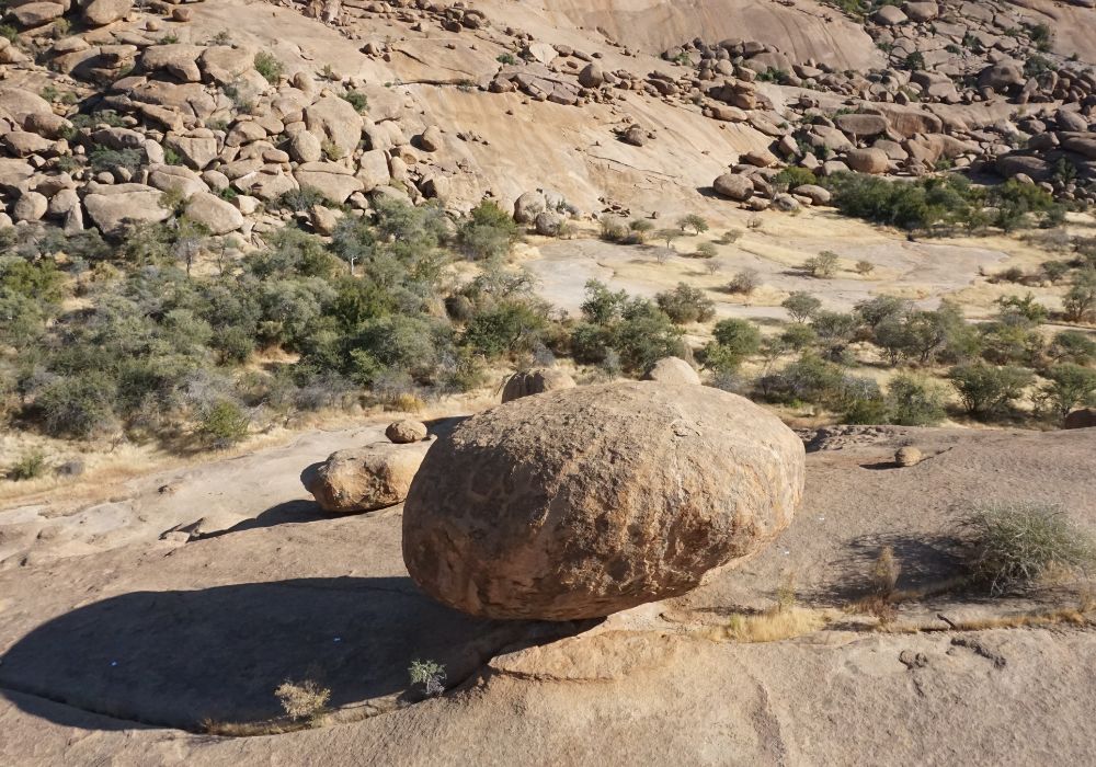
The University of Toronto in Canada requested a detailed survey of a so-called balancing rock on the farm Ameib, situated 30km. north of Usakos. The project involved a drone survey from various heights around the rock connected to accurately surveyed points on the rock surface. A very accurate 3D model could then be created to calculate volumes, center point of the rock and other interesting information.
our WORK
Projects
Single Erf Subdivision
Township Survey
Township Survey
Small development, comprising of two Sections on a residential erf
Large building multiple storey development, comprising of apartments, offices and shops
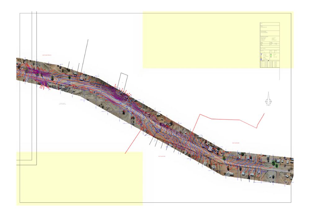
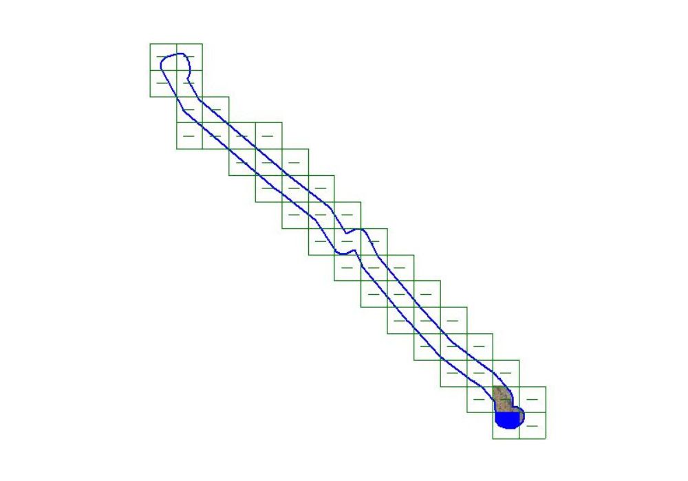
Road Survey
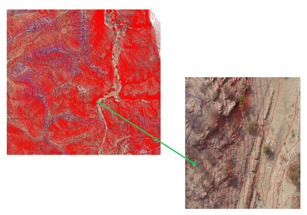
Contour Surveys
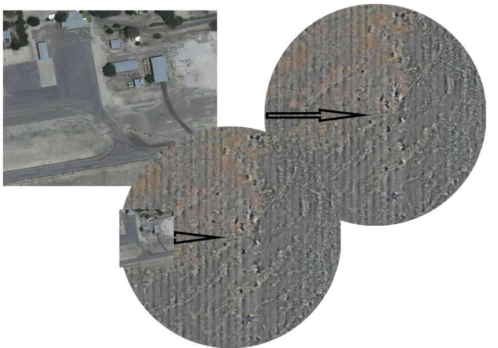
Airport Survey
Balancing Rock
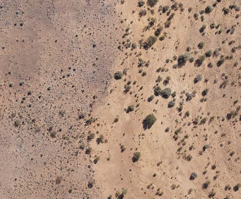
Fairy Circles
Start Your Project
Ready to take the next step? Reach out to us today and let’s bring your vision to life. Whether it’s precision surveys, expert advice, or innovative solutions, we’re here to make it happen.